Household Survey Results
About Manila Tourism & Cultural Development Plan

The Project
This Tourism and Cultural Development Plan intends to enable the City Government in boosting tourism and a cultural reawakening after the covid-19 associated slumber, and in the process recreate business and employment opportunities for the communities and generate revenues for the LGU for the succeeding years.
The Plan contains specific strategies and supporting initiatives in the form of policies, programs, projects, and activities, to promote tourism sites and activities, and at the same time protect and preserve culture and heritage.
Tourism Statistics
Tourist Arrival

Hotel Occupancy Rate

Percentage of DoT Accredited Accommodations

Hotel Length of Stay

Planning Area
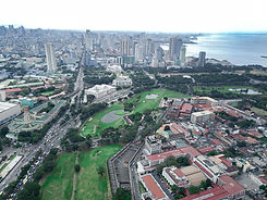
Manila is the capital city of the Philippines. It is situated in Luzon, which the biggest island of the Country. It is bounded by Manila Bay in the west; Navotas City and Caloocan City on the northwest; Quezon City on the northeast; San Juan and Mandaluyong on the east; Makati on the southeast and Pasay City on the southwest. Its total computed area is 40.46 square kilometers. It is politically subdivided into 896 barangays. Each barangay has its own chairperson or punong barangay; and seven councilors.


Tondo Hub

Binondo-Escolta-San Nicoals
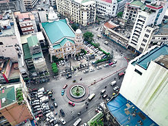
Sta. Cruz

Quiapo

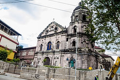
Intramuros and Pasig River
Ermita- Intramuros

Malate